Overview
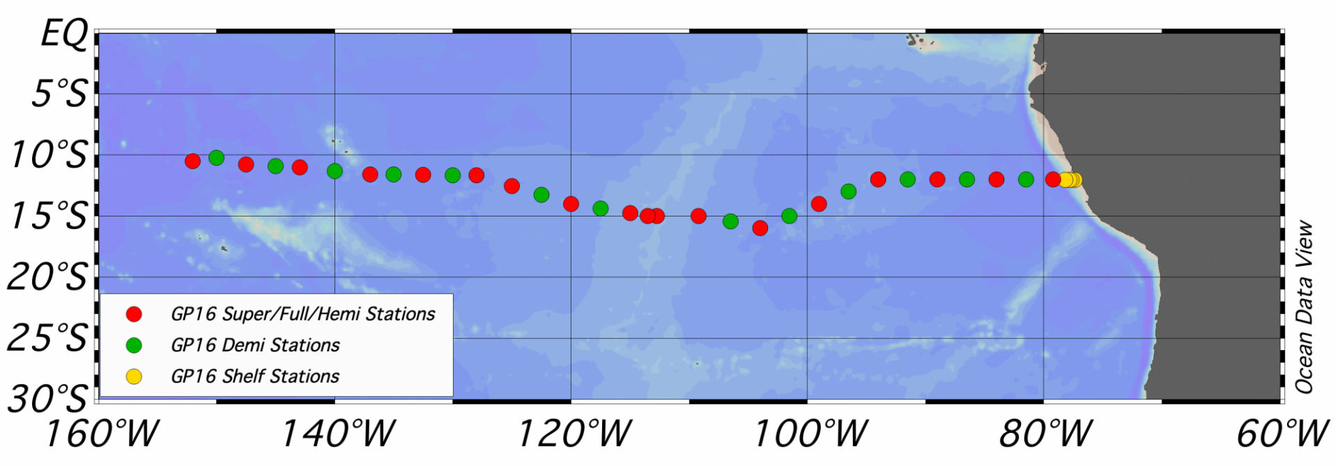
The U.S. GEOTRACES East Pacific Zonal Transect (EPZT GP16 section) aboard the R/V Thomas G. Thompson (University of Washington, Cruise TN303) took place in the tropical Pacific. The ship departed Manta, Ecuador on 25 October 2013 and arrived in Papeete, Tahiti on 20 December 2013. The Chief Scientist was Dr. James Moffett (University of Southern California, USC), with Dr. Christopher German (Woods Hole Oceanographic Institution, WHOI) and Dr. Gregory Cutter (Old Dominion University, ODU) as co-Chief Scientists. The survey included rosette/CTD casts, McLane in situ pump and 7Be pump casts, and a variety of underway measurements. Additional information can be found in the Cruise Information and Datasets Section below.
Dates: 26 - 29 June 2007
Location: University of Hawaii, Honolulu, Hawaii, USA.
The meeting announcement, workshop objectives, agenda, participant list and report are available to download.
Additional information for participants: general meeting information, restaurants, other useful links.
Dates: 1 - 3 October, 2008
Location: University of Southern California, Los Angeles, California, USA
The meeting announcement, agenda, participant list and the Implementation Workshop Report are available to download.
Additional information for participants: driving directions and USC campus map; transportation between the hotel and USC (Taxis); transport between LAX and the hotel/USC (SuperShuttle); accommodations.
Dates: 12 - 14 September 2011
Location: Scripps Institution of Oceanography, La Jolla, California, U.S.
Download the meeting announcements (first, second, final), plenary overview talks and statements of interest.
Other information: travel logistics and reimbursement memo; conference materials.
Dates: 24 - 26 April, 2013
Location: Woods Hole Oceanographic Institution, Massachusetts, U.S.
The Workshop Agenda and List of Participants are available to download.
Dates: 8 - 13 November, 2015
Location: University of Southern California’s Wrigley Institute for Environmental Studies, Catalina Island, U.S.
The Workshop Agenda, the List of Participants and the Presentations Schedule are available to download.
Cruise Information
- Reports
Additional information is available from the Rolling Deck to Repository (R2R):
- Station locations
To generate the cruise track map with Ocean Data View (ODV) use the linked file. Save the file to your computer as a .gob file (e.g. GP16_Stations.gob). How to use the file: within ODV, right click on a surface map an use -> Extras -> Add Graphic Objects from file -> GOB File, then select the *.gob file you wish to use.
Datasets
Parameters sampled and other relevant metadata available from the Biological & Chemical Oceanography Data Management Office (BCO-DMO):
ADCP data available from the University of Hawaii Currents group:
Link to GP16-related peer-reviewed papers database.
Cruise Management Proposal
Investigators who expected to submit proposals to participate in GP16 were encouraged to submit Statements of Interest prior submitting proposals to NSF. The project description of the Management Proposal submitted to NSF in February, 2011 is available to download.
Information on grants awarded to submitted Management Proposals
Source: NSF Division of Ocean Sciences.
Funding Awards: Collaborative Research: Management and Implementation of U.S. GEOTRACES Eastern Pacific Zonal Transect: OCE-1130245, OCE-1130870, OCE-1131731.


