Overview
The first U.S. GEOTRACES section cruises, GA03, took place in the North Atlantic. The original section cruise that was planned to cross the North Atlantic (from Lisbon, Portugal to Woods Hole, Massachusetts, U.S.A) during late Fall 2010, aboard the R/V Knorr was completed in two cruises during the fall of 2010 (KN199-4) and 2011 (KN204-1).
 and KN204-1 (red). Click to download the PDF version of the map.")
The KN199-4 cruise aboard the R/V Knorr departed Lisbon, Portugal in mid-October, 2010 and arrived at Mindelo, Sao Vicente in Cape Verde on November 4, 2010. The Chief Scientist was Bill Jenkins (Woods Hole Oceanographic Institution, WHOI), with Ed Boyle (Massachusetts Institute of Technology, MIT) and Greg Cutter (Old Dominion University, ODU) as co-Chief Scientists. A few weeks into the projected 6-week long cruise, engine problems forced the cruise to be canceled in the Cape Verde Islands. The last station occupied was at Station TENATSO (Tropical Eastern North Atlantic Time Series Observatory).
A year later, the KN204-1 cruise completed the GA03 zonal section across the North Atlantic. The R/V Knorr departed Woods Hole on November 6, 2011 and arrived in the Cape Verde Islands on December 11, 2011, after a short layover on Bermuda. Ed Boyle (MIT) was the Chief Scientist, with Greg Cutter (ODU) as co-Chief Scientist. The cruise crossed the mid-Atlantic Ridge in the vicinity of the TAG hydrothermal field site. The last station of KN204-1 was a re-occupation, and thus a crossover station with the last station of KN199-4, at the TENATSO site near Cape Verde.
Additional Resources
Dates: 10 - 13 September 2007
Location: University of Oxford, Oxford, United Kingdom
The Atlantic Basin Report is a summary of the discussions and recommendations developed during the workshop and is available to download.
Other relevant documents available to download: Workshop Final and Preliminary Announcements; List of Participants and Agenda.
Dates: 22 - 24 September 2008
Location: Woods Hole Oceanographic Institution, Woods Hole, MA, U.S.
The meeting announcement, its outcome summary and the North Atlantic Zonal Section Implementation Plan are available for download. A brief article published in Ocean Carbon & Biogeochemistry News, October 2008 (page 9) summarizes the project.
- KN199-4 Pre-cruise Planning Meeting
Dates: March, 2010.
Location: Old Dominion University, Norfolk, VA, U.S.
- KN204-1 Pre-cruise Planning Meeting
Dates: March, 2011.
Location: Old Dominion University, 2011, Norfolk, VA, U.S.
Dates: 11 - 15 March, 2013
Location: Old Dominion University, Norfolk, Virginia.
The Workshop List of Participants, Agenda, Report and Group Picture are available to download.
Cruise Information
- Reports
Additional information available from the Rolling Deck to Repository (R2R):
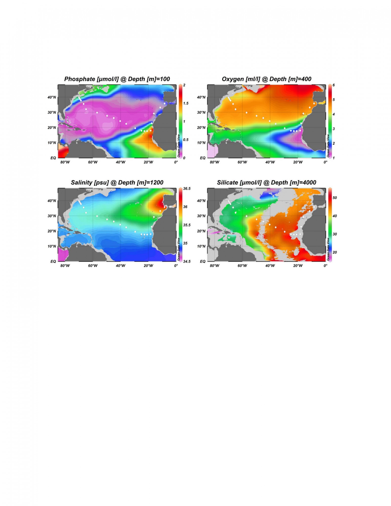
- Station locations
To generate the cruise track map with Ocean Data View (ODV) use the linked file. Save the file to your computer as a .gob file (e.g. Map_Stations_GA03.gob). How to use the file: within ODV, right click on a surface map an use -> Extras -> Add Graphic Objects from file -> GOB File, then select the *.gob file you wish to use.
Datasets
Parameters sampled and other relevant metadata available from the Biological & Chemical Oceanography Data Management Office (BCO-DMO):
ADCP data available from the University of Hawaii Currents group:
Link to GA03-related peer-reviewed papers database.
The scientific rationale for the GEOTRACES program is laid out in the GEOTRACES Science Plan and related activities planned for the Atlantic Basin are described in the Atlantic Basin Report and the North Atlantic Zonal Section Implementation Plan.
Pre-proposal Statements of Interest
Investigators who expected to submit proposals to participate in GA03, regardless of whether they had attended the planning meeting, were encouraged to submit Statements of Interest, prior submitting proposals to NSF. Proposals were submitted in February and August, 2009.
Cruise Management Proposal
After the planning meeting, a management proposal was submitted to, and approved by, NSF. The project description of the Management Proposal and an abbreviated description of management services are available to download. A series of images in Microsoft PowerPoint, Adobe Portable Document Format and standard JPEG formats were made available for use in preparing proposals.
Information on grants awarded to submitted Management Proposals
Source: NSF Division of Ocean Sciences.
Funding Awards: Collaborative Research: Management and Logistics Operations for the U.S. GEOTRACES Zonal North Atlantic Survey Section: NSF 09-26092, NSF 09-26423, NSF 09-26204.
NSF-funded proposals
Table summary of the NSF-funded proposals that allowed participation in the U.S. GEOTRACES North Atlantic Zonal Section, GA03.
Funding and Support